What types of precipitation will we see this week? Rain, freezing rain, sleet, rain-snow mix, or snow? How about all of the above!! This is the most excited the weather has made me all winter long. We have a lot to go over: We have system that will be moving through on Tuesday, then a bit of a break, then a potentially more impacting system that will be moving through the Midwest Thursday into Friday.. a lot to discuss.
Let’s begin.
Tuesday’s Storm Discussion
Tuesday’s storm is a bit tricky even 36 hours out because the temperatures will be a huge factor. 29 degrees means one thing while 33 degrees means another. Let’s go through the day hour by hour.
Tuesday morning 6-8 am: The temperatures will likely be around 30 or 31 degrees with moisture moving in from the south and west. The lowest levels of the atmosphere won’t be totally saturated so once the bands of precipitation begin to move in, it may take 30 minutes or an hour for it to actually reach the ground. This is really important because will actually cause our temperatures to cool a degree or 2 down to 28 or 29 degrees due to what is called evaporative cooling (the moisture will evaporate as it falls toward the ground through the layers of the atmosphere which requires a heat exchange– the water droplets require heat for them to evaporate which causes the surrounding environment to lose heat causing our temperatures to cool).
9-12 pm:
The latest nam model run has the precip beginning just before 9 as sleet or a mix of snow and sleet. After looking at the thermal profiles through the lowest levels of the atmosphere, I think we could see a period of snow at the onset of the storm, then transitioning to a mix.
Around noon we will see an elevated warm layer develop to due a strong push of warm air advection:
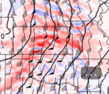
You see the dark red line just south and west of Kansas City? As this moves before the noon hour, we will see our snow/sleet chances diminish as the elevated warm layer develops. At noon, the temperature at the surface should be just below freezing at 30 degrees give or take. This will set the stage for a window of freezing rain.
This is valid at 3 p.m Tuesday. Temperatures will slowly be rising above freezing. You can notice that the precip is more intense as you move west of the MO-KS state-line. This is something to take note of as KC will likely be on the edge of the most precipitation from this first round. The temperatures will rise above freezing by the afternoon and we will likely see a break in the action followed by a round of rain ending around midnight or so.
Now the big question, how much? The bigger question is how much of what? That’s a hard question answer.
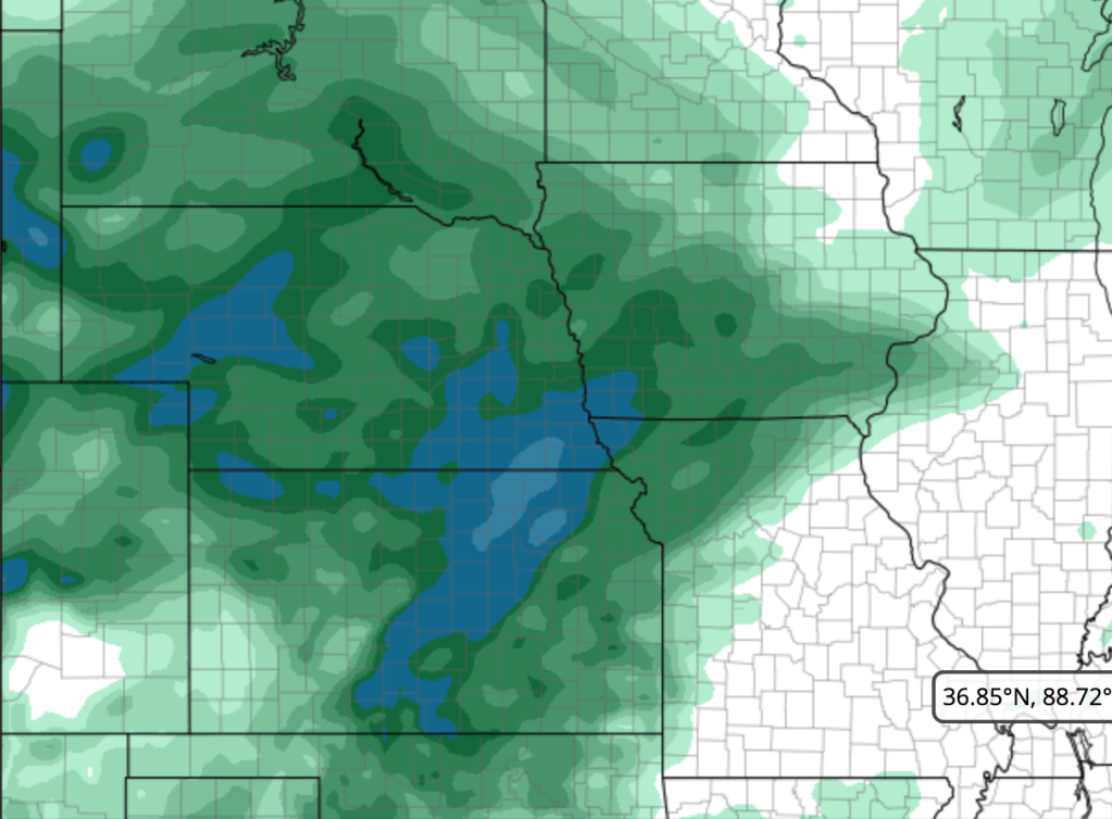
This is the QPF output ending at 3 pm– this likely in the form of snow, sleet, and freezing rain… quite a tough forecast. This is about 0.15-0.35 for the KC metro area.
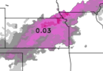
This is the total amount of freezing rain the is forecasted to fall. This about 0.1-0.2 for the KC metro. Based off of this information. my best forecast would be: that we will likely have a dusting of sleet/snow Tuesday morning proceeded by a period of freezing rain producing a few hundredths of an inch of ice (<0.1). As you can probably tell, this is a very complex situation with temperatures and precip type being in flux. This may not sound like much in the terms of creating issues, but even just a few hundredths of an inch of ice can create hazards, so Tuesday mid-morning could be dicey.
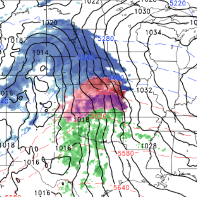
Friday’s Storm Discussion
After the mid week storm moves away, it will leave behind an area of energy in south Texas.
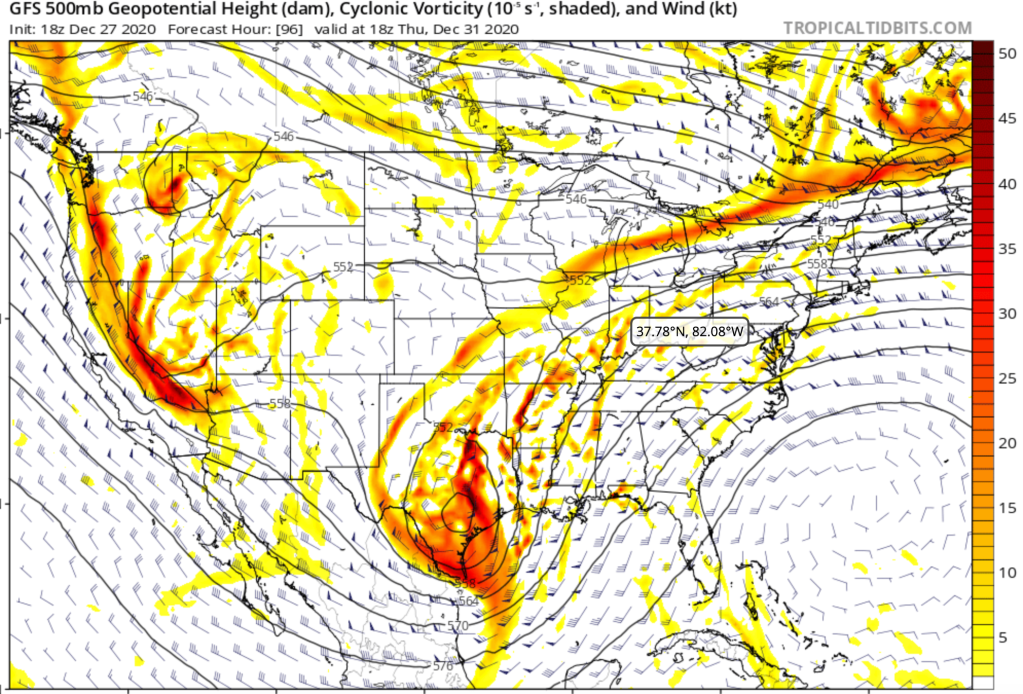
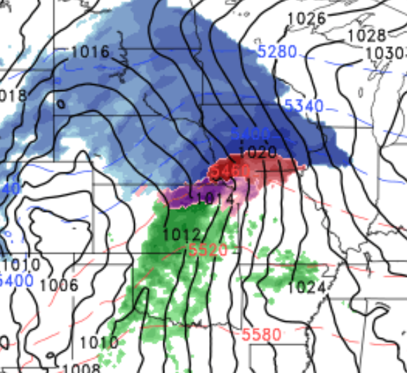
The track of that circle you see will depend on if we see a 10 inches of snow or nothing. Some models look this:
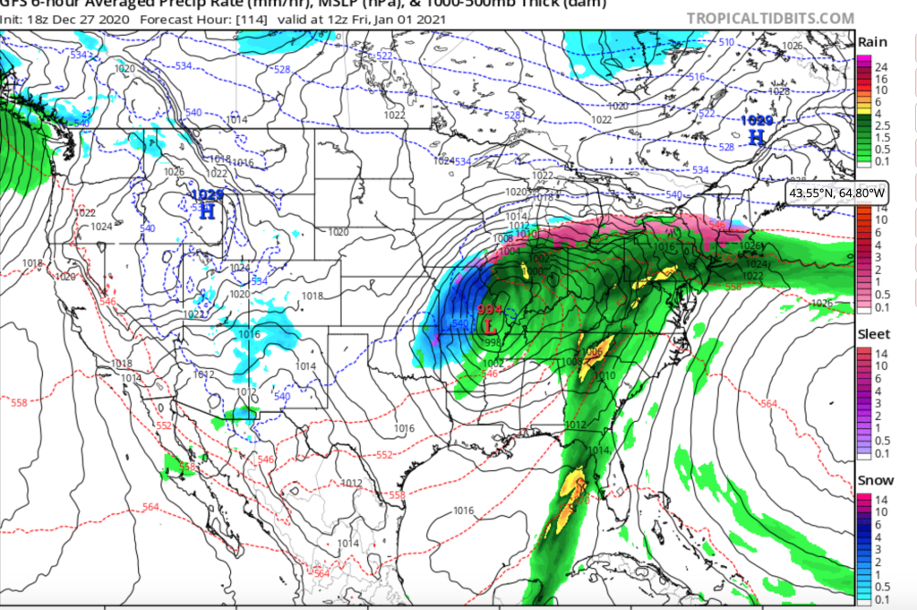
Some look like this:
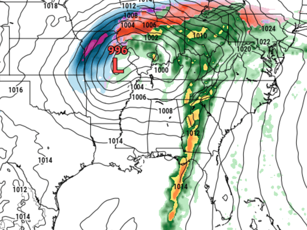
50 miles may be the difference between a major winter storm and no snow. It certainly has my attention and there is a much higher potential for accumulating snow from this system than the one on Tuesday. I will have in depth update regarding this storm on Tuesday or Wednesday. Stay safe on Tuesday morning!
Stay tuned.
Jack

Awesome!
LikeLike